Topic: Discussion on the Hampton Corridor Traffic Study (Link to Study below)
Presentation by the Lochmueller Group w/Alderman Oldenburg
Place: Online via Zoom
When: Tuesday, October 27, 2020 at 7 pm
Zoom Link: https://us02web.zoom.us/j/87860917469
Meeting ID: 878 6091 7469
Call in no. 312-626-6799
- Go to the Link above any time between now and October 27th
- Fill out required information to reserve your spot (Name & Email address)
- Click on “Register”
- You will receive an email confirming your registration. Participants will need the link & meeting ID to enter the meeting.
- If you do not have a computer or smartphone, use the call in number listed above and you will be connected to the meeting audio.
PURPOSE
The purpose of this study was to determine the feasibility of reducing traffic lanes along Hampton Avenue between Chippewa Street and Gravois Avenue. The motivation for reducing lanes or implementing a “road diet” is a desire for Hampton Avenue to more effectively serve all users of the street, including pedestrians, cyclists, transit users, and motorists. Today, Hampton Avenue functions as an arterial street that prioritizes vehicle traffic over other modes. Hampton has two traffic lanes in each direction. Traffic signal cycles are long to accommodate through traffic. Many areas along the corridor lack adequate pedestrian and bicycle infrastructure.
At the same time, the land use context along Hampton Avenue is evolving. Small businesses and restaurants are reinvigorating existing commercial buildings. These new businesses, particularly the restaurants, have amplified the need for parking. Many restaurants rely upon on-street parking along Hampton Avenue to serve their patrons. Adjacent neighborhood residents are more and more seeking a walkable community and an urban experience.
Implementing a “road diet” along Hampton Avenue would reduce traffic speeds, improve safety, and promote a more welcoming environment for non-motorized users of the street. This study objectively evaluates the feasibility of a “road diet” along the Hampton Avenue corridor by detailing its anticipated benefits and impacts to traffic.
LOCATION
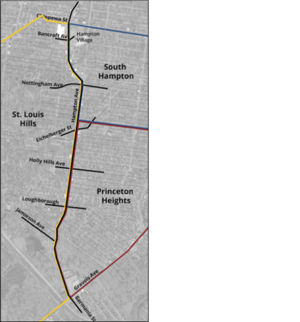
The study runs along Hampton Avenue from Chippewa Street to the north to Gravois Avenue to the south. This area touches both Ward 16 and Ward 12 of the City of St. Louis and three neighborhoods – St. Louis Hills, Princeton Heights, and South Hampton. The surrounding neighborhoods are mostly single-family. The northern portion of the corridor is commercial including large retail centers with off-street parking, such as the Hampton Village Shopping Center. The middle portion contains small-scale commercial uses with buildings abutting the sidewalks and on- street parking. The southern portion of the corridor is lined with mostly residential uses and Willmore Park.

